Using dedicated surveys and data from satellite tags, we identified areas where blue whales concentrate in Chilean Patagonia. We show that the main vessel traffic corridor highly overlaps with these areas, where higher risk of negative interactions between vessels and whales is to be expected, and that the aquaculture fleet is, by far, the largest and most densely distributed fleet in the area.
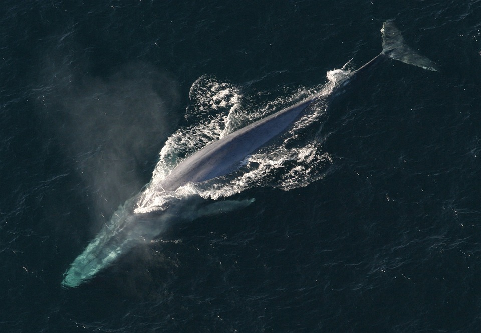
After decades of whaling, the last sanctum for blue whales of the eastern South Pacific Ocean was found off the coast in Northern Chilean Patagonia (NCP). Here most of the population concentrates during the summer and autumn seasons of the Earth’s southern hemisphere (also known as austral summer and austral autumn) to feed and nurse theiryoung. Unfortunately, negative interactions between whales and vessels represent a major threat to whales worldwide, including collisions with ships, alterationsto their normal behaviour, and heavy noise exposure, among others. These interactions might hinder the recovery of depleted populations, which is the case for most blue whale populations. As such, identifying areas where whale populations concentrate and how they interact with human activities is of paramount importance for orienting conservation actions.
In order to identify the high risk areas for blue whales, we combined data from various sources: dedicated surveys where whales’ locations and numbers are determined, tracking data from whales instrumented with satellite tags so that their movements can be followed, and oceanographic information derived from satellite images to identify the main areas that whales select in NCP. We used tracking data from four vessels fleets, namely, aquaculture, industrial fishery, artisanal fishery, and transport fleets. By analyzing these data, we were able to determine the vessel density in the study area for each of the four fleets and overlap it with the population distribution of whales. This, in turn, helped us estimate the probability of encounters between whales and vessels, thereby giving us a way to measure the risks posed by the vessel traffic of the region.
Four areas were highlighted as the most important concentration areas for blue whales in NCP. These areas not only presenteda large supply of microalgae for krill (a primary food source for whales) but were also characterised by regions where distinct water masses collided (a.k.a. thermal fronts), as a result of which krill swarms were concentratedand the whales could prey upon themmore efficiently. Once we identified these important concentration areas for whales, we then moved on to describe the distribution of vessel traffic in the study area.
When considering all fleets together, we found that around 1000 vessels used the area daily. By inspecting their spatial distribution, a clear traffic corridor was evident within NCP waters, traversing two of the most important areas of blue whale concentration. This corridor connected different local cities and the main port in the area, Puerto Montt, with aquaculture facilities. It spread across channels and fjords, and served as a safe navigation route for all kind of vessels traversing the area. When considering each fleet individually, we found that artisanal fishing vessels presented the highest overlap with whale populations, while the remaining three showeda similar but lower degree of overlap. However, when we considered fleet size, the aquaculture fleet stood out from the rest. They represented 83% of all vessels considered in this study and corresponded to the largest, most densely distributed and diverse fleet in the NCP with vessels ranging from 5 to 100 meters length. Taking this into account, it is possible that this sole industry represents the major driver of local negative vessel-whale interactions.
We have shown that the “marine highway” located off NCP should be the focus of further studies as the risk of vessels striking whales, among other threats, is much higher in this region. Despite ship strikes being a poorly studied phenomenon and rarely being reported in Chile, most of those that were reported in NCP occurred in areas around this highway. Moreover, shortly after the publication of our research, a young blue whale male was found dead in one of the high-risk areas depicted by our study. The carcass washed ashore and a necropsy team confirmed that a ship strike was the cause of death.
Marine traffic regulation — such as setting navigation routes, imposing speed limits and putting in place alert systems to inform vessels about the proximity of whales— are some of the tools that should be explored soon. In order to achieve this, a close collaboration between researchers, stakeholders and local authorities is needed. Previous studies have shown that blue whale population recovery might be jeopardized by the loss of even a few individuals per year, after having already been severely depleted by the whaling industry during the 20th century. Whether these whales are going to be able to thrive in this century will depend, among other things, on how we regulate oceans filled with vessels and still very few whales.
Original Article:
Bedriñana-Romano, L., Hucke-Gaete, R., Viddi, F. A., Johnson, D., Zerbini, A. N., Morales, J., Mate, B., & Palacios, D. M. (2021). Defining priority areas for blue whale conservation and investigating overlap with vessel traffic in Chilean Patagonia, using a fast-fitting movement model. Scientific Reports, 11(1), 2709. https://doi.org/10.1038/s41598-021-82220-5

 Evolution & Behaviour