
 Earth & Space
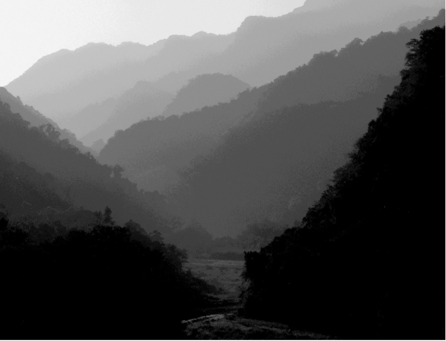
How rain sculpts mountains
Climate, as characterized by rainfall, has a profound influence on rivers in mountain ranges. While it may seem obvious how heavy rain causes flooding and river incision, scientists have struggled to model how rainfall and erosion are related. We show a new model that accurately predicts the relationship in the Himalaya, which helps us better understand the evolution of mountainous landscapes.
The shape of Earth's surface can tell us a lot about what kinds of natural events have happened in a region and when. Heavy rainfall, for instance, causes rivers to swell, which can force a river to erode faster into its bed. This connection between rain, flooding, and river downcutting is easy to envisage, even for those who have not experienced it. But is this intuition of ours correct all the time?
Even though many scientific studies treat this connection between rainfall and erosion as a foregone conclusion, the geoscience community has struggled to show how this relationship plays out in natural landscapes in an accurate way. Clearly defining this relationship will help us understand how rivers responded in the past and will respond to future climate changes.
To this end, we studied a mountain range – a geological setting where rivers predominantly cut down into bedrock and where erosion rates (the removal of bedrock from the surface over time) and rainfall rates (the average amount of rain that falls in a year) can be very high. In such rugged landscapes, the connection between rainfall and erosion is particularly important. We focused on the Himalayan mountain range in the countries of Nepal and Bhutan, where a variety of river steepness, erosion rates, and rainfall rates provide ideal settings for the study.
To probe how rainfall controls erosion, we needed to know how much it rains in a year, how fast rock are eroding, and how steep rivers are across the Himalaya. Luckily, rainfall data and elevations of river channels can be obtained from freely available datasets collected by satellites. We determined the erosion rates using "cosmic clocks". When high-energy radiation from outer space reaches Earth, the resulting reactions create a rare element in sand grains on hillslopes as they are transported toward rivers. We can then measure how many atoms of this rare element are present in a sample of river sand, and calculate how long the sand has remained there (how long the "cosmic clock" has run), which tells us how quickly the landscape has been eroding. Using these observations, we tested a wide variety of numerical models of river erosion.
One model was able to predict the observed erosion rates more accurately in the Himalaya. This result demonstrates that changes in rainfall rate are likely to produce proportional changes in erosion rate. For example, if rainfall rates were to double then erosion rates would be expected to double. However, there could be some period of time between the initiation of rainfall change and the actual change in erosion. This model also tells us that the frequency and intensity of storms, and the energy required to move pebbles and boulders along the riverbed are critical to understanding how rivers respond to long-term changes in rainfall.
The results of this study help us better understand the influence of changing rainfall on river erosion, which is critical to understanding how mountain ranges have evolved over time. The proportional relationship between rainfall and erosion sets the scale of mountain range relief, because rivers change their steepness to accommodate new erosion rates. For example, if rainfall rates increase, then a river will decrease its steepness over time to maintain a balance between erosion rate and the rate that rocks are being pushed toward the surface. This means that the ruggedness or steepness of mountain ranges is set both by the forces that push mountains up and the regional climate.
The model also highlights that the observed river erosion rates were mainly driven by big storms, which suggests that rivers are not always eroding their beds. This result may speak to the poetic nature of babbling brook and raging torrent from our archetypal intuition. The next time you are enjoying a quiet moment next to a mountain river, you might imagine that it is as peaceful as you – until the next storm arrives. When the storm arrives, the river levels rise, the water froths and becomes murky with sediment, and the river will finally begin the work to cut down into its bed. Indeed, should you be lucky enough to be near that river in the rugged mountains during such a storm, you might actually hear the roar of human-, car-, or even larger sized boulders rolling downstream, chipping away at the Earth's crust and setting the form and function of our majestic mountain ranges.
In summary, we demonstrated the relationship between erosion and climate in the Himalaya. This tells us about how the mountains evolved to their current form, how they are eroding today, and how landscapes will adjust as climate continues to change across the globe. Looking forward, these findings can be used to better inform models of landscape evolution in an effort to improve land use management and mitigate future natural hazards.
Original Article:
Adams, B. A., Whipple, K. X., Forte, A. M., Heimsath, A. M. & Hodges, K. V. Climate controls on erosion in tectonically active landscapes. Sci. Adv. 6, (2020).
Edited by:
Dr. Akira Ohkubo , Associate Editor
We thought you might like
Ocean acidification and its effects on coral reef growth
Jul 8, 2016 in Earth & Space | 3.5 min read by Rebecca AlbrightResetting nature’s clock: shifting seasons and species relationships
Sep 14, 2016 in Earth & Space | 3.5 min read by Stephen Thackeray , Sarah BurtheThe silent battle of young corals against ocean acidification
Oct 19, 2016 in Earth & Space | 4 min read by Taryn FosterFor polar bears the cost of living is rising
Mar 13, 2018 in Earth & Space | 4 min read by George DurnerMore from Earth & Space
Likely increase in coral thermal tolerance at a Pacific archipelago
Dec 29, 2023 in Earth & Space | 3 min read by Liam LachsEarth’s large lakes are shrinking
Dec 27, 2023 in Earth & Space | 3 min read by Fangfang Yao , Ben Livneh , Balaji RajagopalanGas in distant galaxies: mixed or matched?
Nov 22, 2023 in Earth & Space | 3 min read by Tanita Ramburuth-HurtThe astonishing jet of an extreme gamma-ray burst
Nov 20, 2023 in Earth & Space | 4 min read by Brendan O'ConnorOn how to use earthquakes to study a volcano
Oct 16, 2023 in Earth & Space | 4 min read by Carmen del Fresno , Simone CescaEditor's picks
Trending now
Popular topics